
MRTS04 earthworks: lots, layers and testing explained
How general earthworks are lotted, layered and released on Queensland TMR projects, and how to keep the lot register matching what was actually built.
Where MRTS04 sits in the TMR specification set
Queensland's Department of Transport and Main Roads publishes earthworks requirements across a small family of documents that reference each other.
MRS04
Standard specification, general earthworks
The standard specification document for general earthworks. It is the contractual half of the pair and is read together with the technical specification.
MRTS04
Technical specification, general earthworks
The technical requirements for cut, fill, subgrade and related earthworks: materials, placement, compaction, tolerances, testing and the hold points that release the work.
MRTS03
Drainage, retaining structures and protective treatments
Covers drainage and related structures that interleave with earthworks lots on the same corridor, so lots for both often sit in one register.
MRTS05
Unbound pavements
Picks up where earthworks finishes. Pavement layers are lotted the same way, stacked on the same ground footprint as the subgrade beneath them.
This guide explains the concepts in our own words. It does not reproduce specification text, clause numbers or testing frequencies. The current issue of the specification and your project's annexures always govern, and they are published on the Transport and Main Roads specifications page.
How a lot is defined on an earthworks job
A lot is a parcel of work of uniform material, method and conditions, built as one layer and inspected and tested as a single unit.
Uniform material and method
One source, one placement method, one set of plant and conditions. A change of borrow pit, moisture regime or compaction plant is a reason to close the lot and start another.
One layer, one lot
Each fill lift, the prepared subgrade and each capping or pavement layer is its own lot, even where they stack on the same footprint of ground.
Located by chainage and offset
Chainage from and to, left and right offsets, so the lot is unambiguous on the corridor and can be found again during an audit years later.
Earthworks layers, lot extent and release
A working summary of how earthworks layers are usually lotted and released. Treat it as orientation only, then set the detail from your specification and annexures.
| Layer | What sets the lot extent | Typical conformance checks | Release |
|---|---|---|---|
| Topsoil strip | Strip area, usually broken by chainage run or work front | Setout and extent, strip depth, stockpile separation | Witness point before stripping starts |
| Cut to subgrade | Chainage range and offsets of uniform material and method | Material assessment, level and shape tolerance, proof roll | Hold point before capping or pavement |
| Fill lift / embankment | One lift of uniform material placed under uniform conditions | Source conformance, layer thickness, density ratio, moisture ratio | Hold point at each lift before the next is placed |
| Subgrade preparation | Chainage range and offsets, split at material or treatment changes | Moisture conditioning, compaction, proof roll, surface level | Hold point before any overlying layer |
| Select fill / capping | Chainage range and offsets per placed layer | Material properties, thickness, density, level tolerance | Hold point before pavement layers |
Need a starting document? Download our free earthworks ITP and lot register templates in CSV and printable PDF, no signup required.
A subgrade lot from setout to release
The same sequence repeats hundreds of times on a corridor job, which is exactly why the register gets out of step with the ground.
Subgrade is prepared between chainage 1,200 and 1,400, 0 to 8 m left, all in the same material and with the same plant, so it is opened as a single lot.
The lot is created against the earthworks ITP, tagged to the subgrade layer, and its area is derived from the chainage extent and offsets rather than typed in by hand.
Moisture conditioning and compaction are completed, field density and moisture results are taken across the lot and the surface is surveyed for level and shape.
A proof roll is called as a hold point. The lot sits at awaiting inspection until the superintendent's representative attends.
Results pass, the lot is released with its conformance date, and only then does capping go over it. Had a result failed, the lot would be marked for rework and the area stays visibly blocked on the map.
Running an MRTS04-style lot register on the alignment
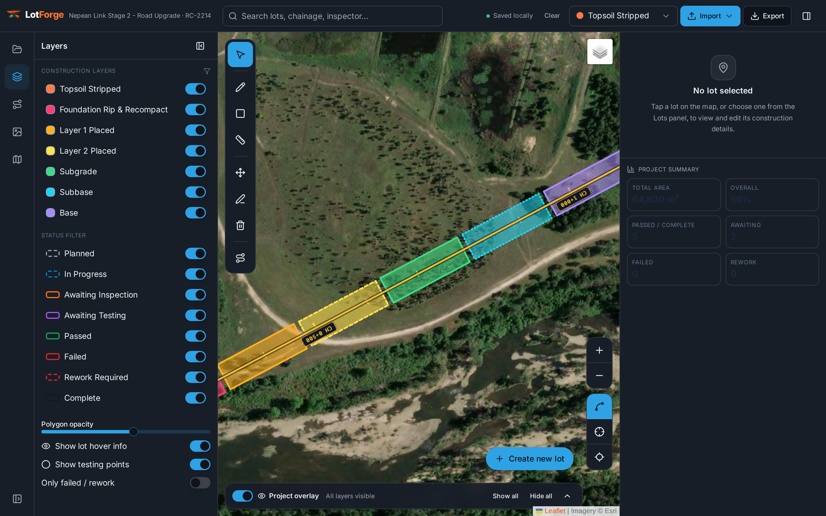
ForgeLot keeps the register attached to the survey geometry, so lot extents, areas and hold point status describe the actual ground.
1. Anchor lots to the design alignment
Import the design DXF, lock the control line and generate chainage. Lots are then described in the same chainage and offset language MRTS04 hold points and your ITPs already use.
2. One lot per layer, per parcel
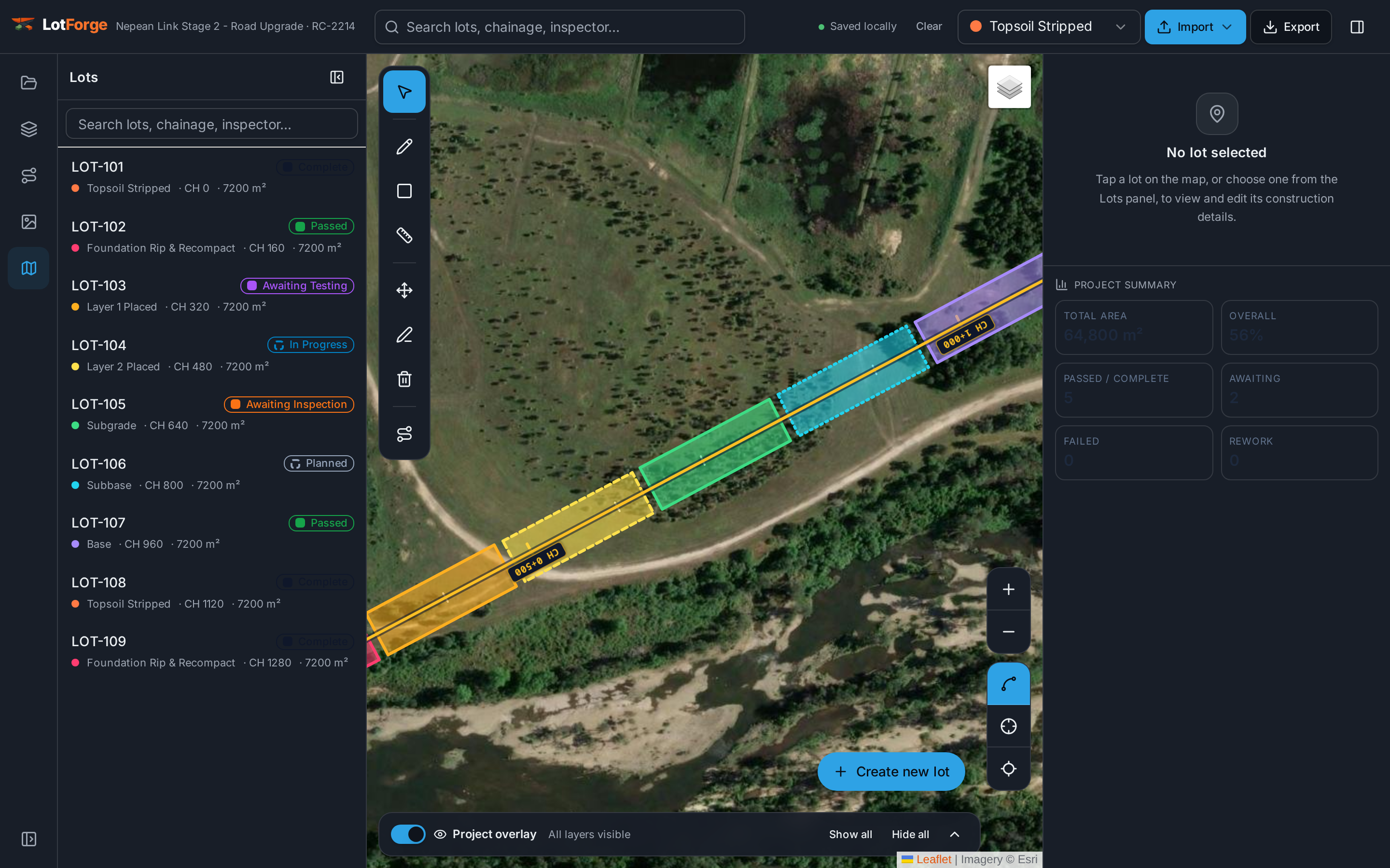
Draw the lot by chainage range and offsets and tag its construction layer. Fill lifts, subgrade and capping over the same ground stay separate records with separate conformance.
3. Track hold points as lot status
Move each lot through awaiting inspection, awaiting testing, passed or rework required. The map recolours, so nobody covers a lot that has not been released.
4. Export the register for the superintendent
Lot numbers, chainage extents, layers, areas, statuses and conformance dates export to CSV or PDF in the structure Australian road authorities expect.
Progress and conformance from the same records
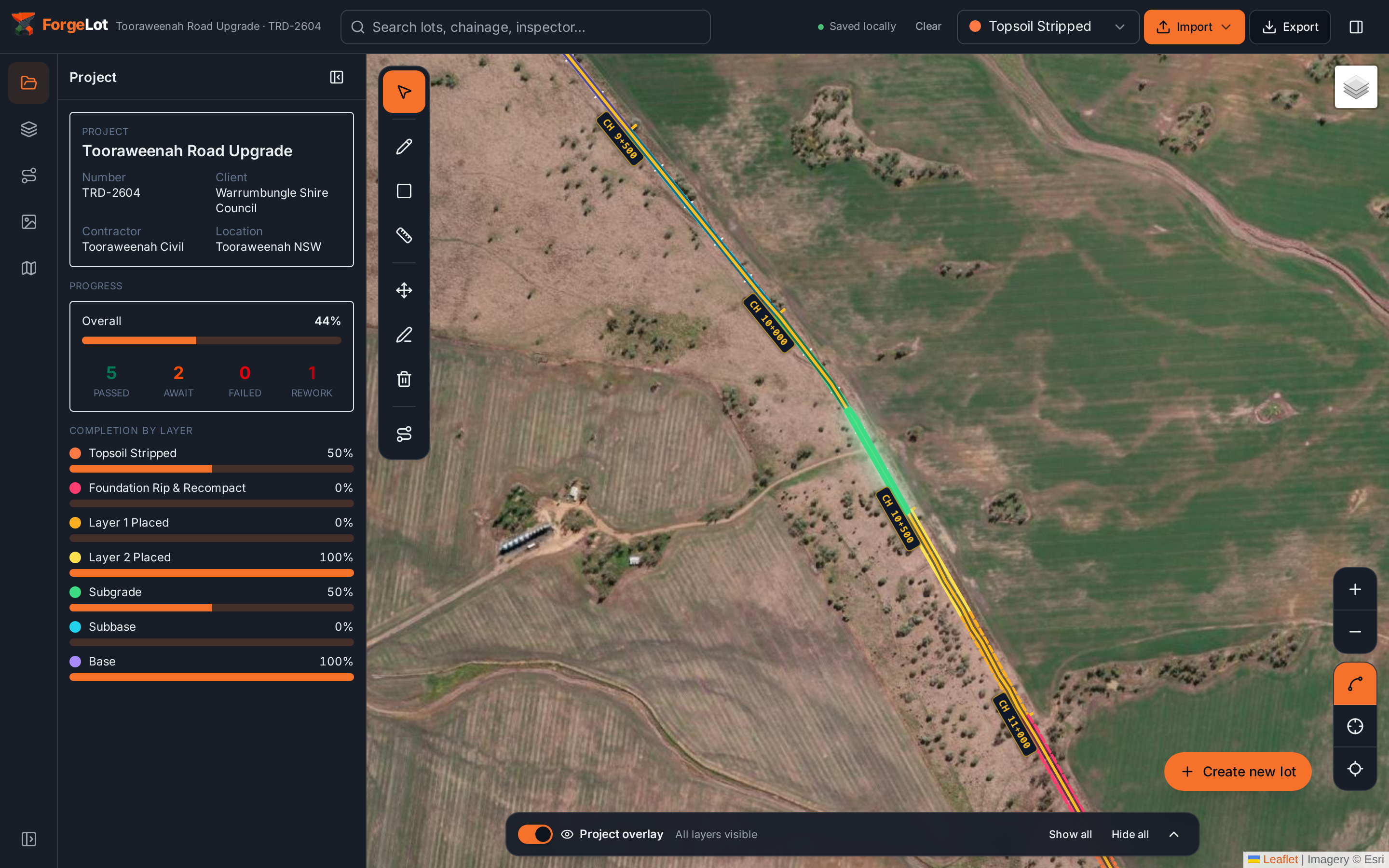
Because status lives on the geometry, completion by layer and the conformance summary come from the records the crew already updates on site.
MRTS04 and earthworks lot FAQs
Common questions from engineers and QA staff setting up lots on Queensland TMR earthworks.
More on ITPs, hold points and registers in the ITP and lot register guide.
Stop guessing what's been built.
Import your alignment, forge your lots and share a live picture of progress with the whole team.
14-day free trial · Cancel anytime · Your data stays yours