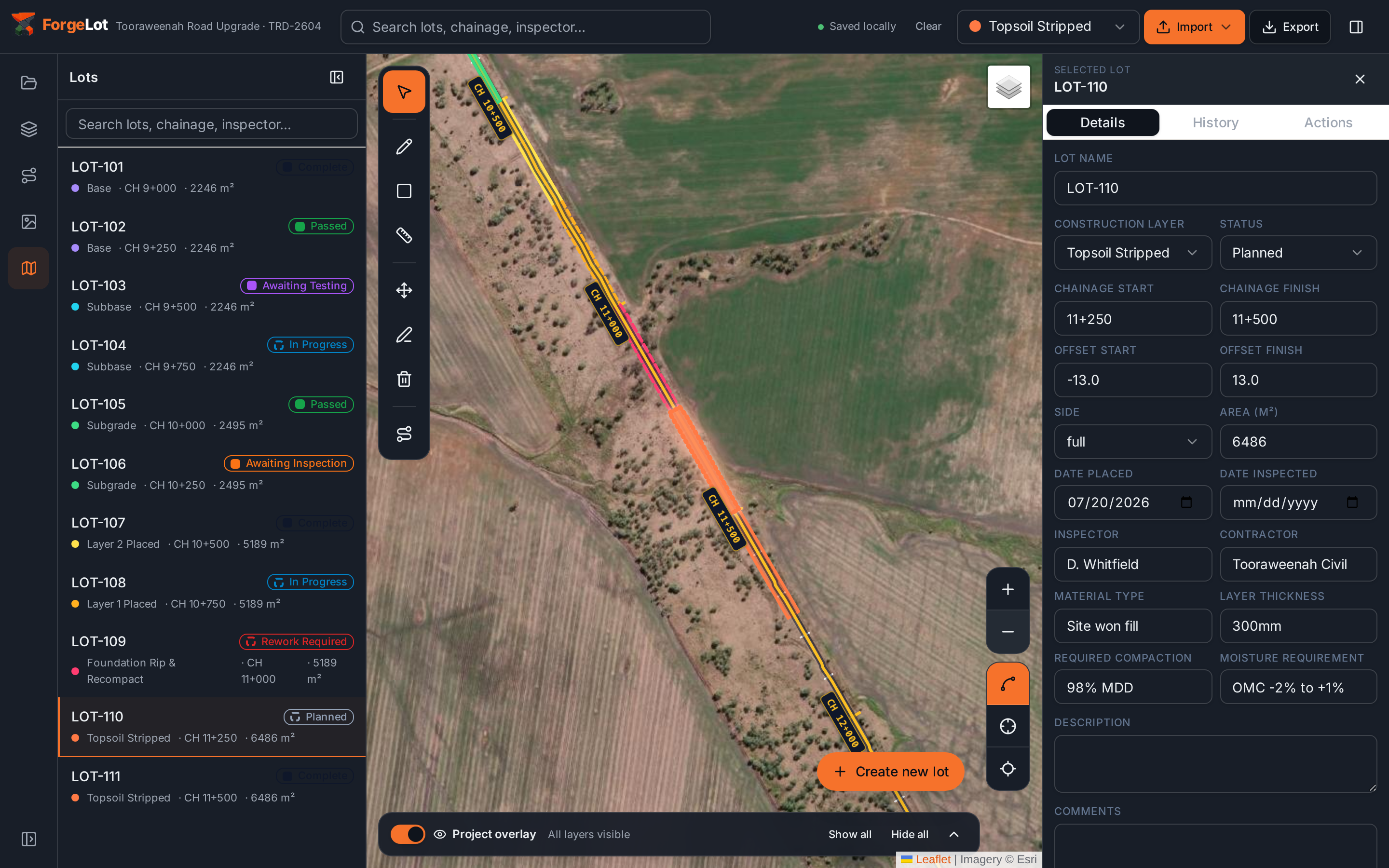
Bulk earthworks
Large work fronts stay visually distinct while quantities, status and inspection detail remain one click away.

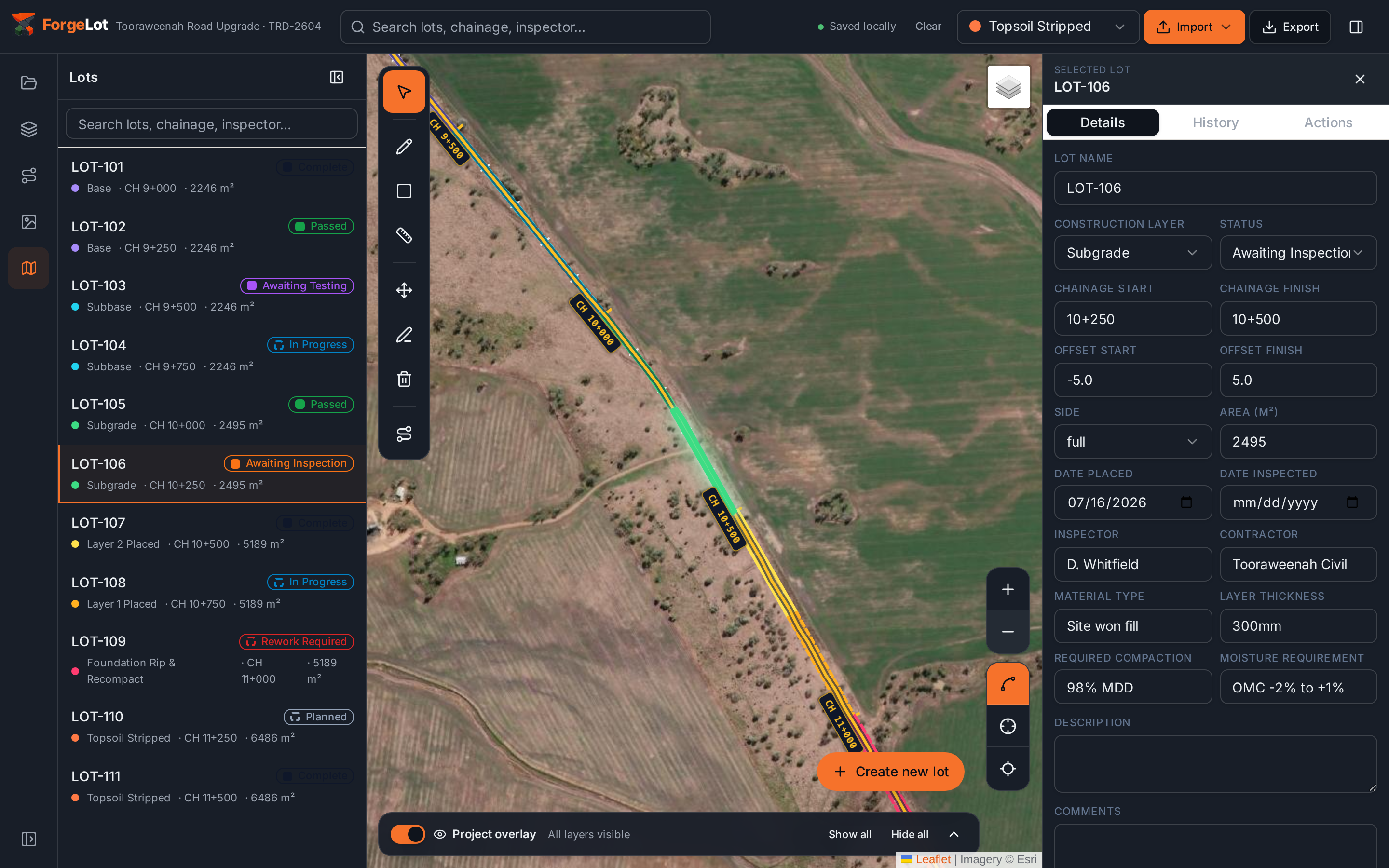
Built for civil construction teams
ForgeLot turns your DXF alignment into a live map of construction lots, layers, inspections and progress your whole team can trust.
This is the actual ForgeLot workspace: satellite and drone imagery underneath, engineering chainage on the control line, and every lot clearly identified by layer and status.
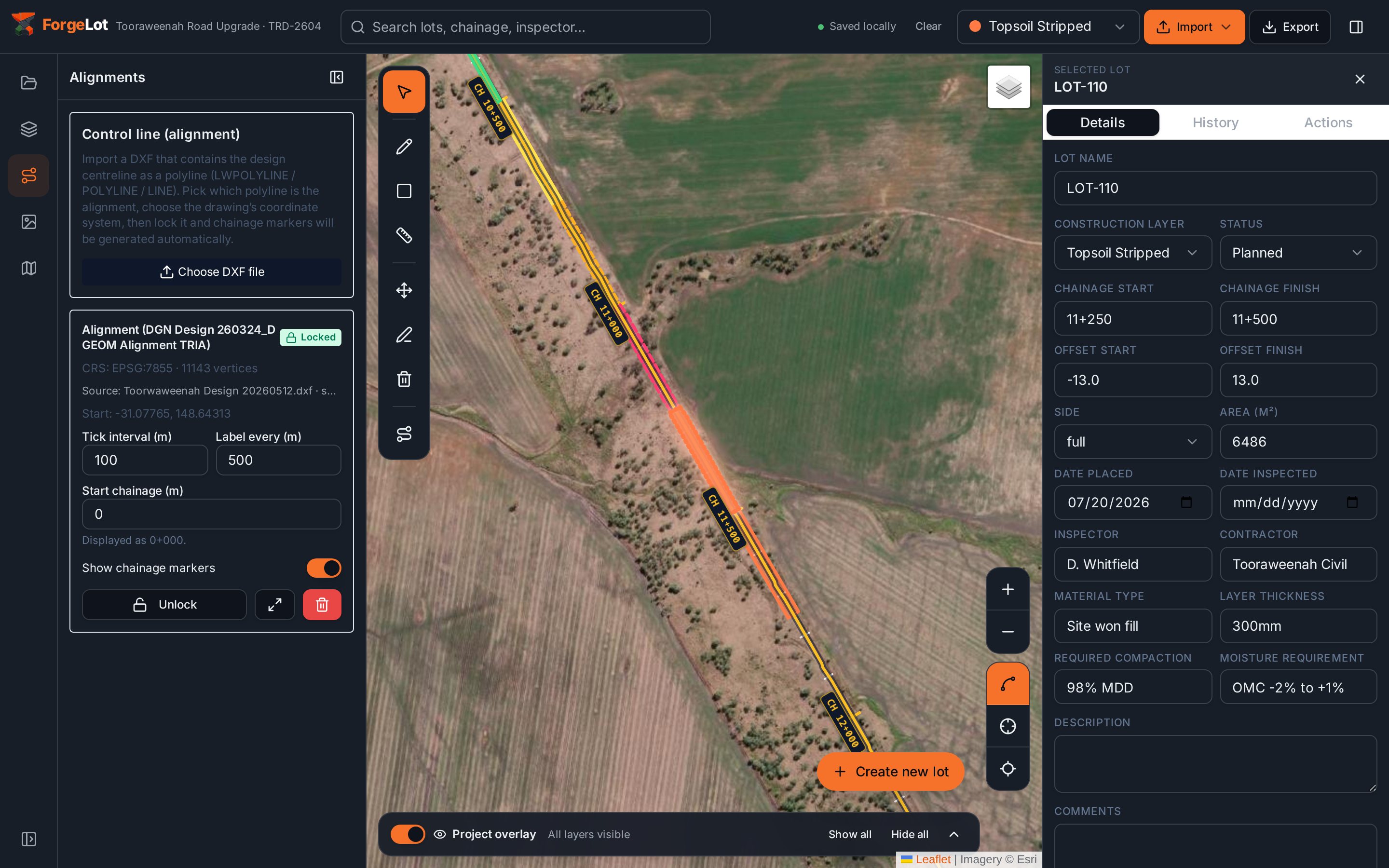
Lock a DXF control line, tune marker intervals, upload drone imagery and build lots by chainage and offset, all without leaving the map.
Explore every featureMove from a corridor-wide view to the detail of one lot without losing the construction context.
Large work fronts stay visually distinct while quantities, status and inspection detail remain one click away.
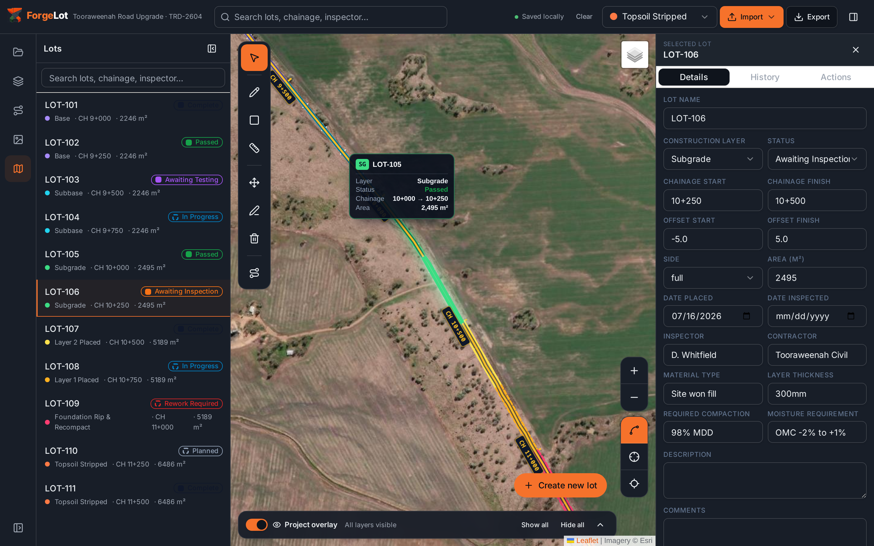
Hover a lot to make it vivid and reveal its number, category, chainage, status and area without cluttering the map.
No redrawing the job and no parallel register to reconcile. Start with the design information your project already uses.
Upload the project DXF and confirm the coordinate system. ForgeLot places it over the real site automatically.
Select the control line, set your chainage interval and keep every lot tied to the same engineering reference.
Enter chainage and offsets to draw lots in real time, then move them through construction and QA statuses.
The cost of a lot register is rarely the software, it's the engineering hours spent building it and the rework when it doesn't match the ground.
Lots are created from chainage and offset in seconds, with areas calculated for you. No CAD take-offs, no retyping lot numbers into a spreadsheet.
Every lot is tied to the locked control line, so chainages, offsets and areas stay consistent. Gap and overlap checks catch missed or double-claimed work before it reaches a claim.
Quantities by layer and status are always current, so monthly progress claims and QA handover packs are exported, not rebuilt.
If building and reconciling the lot register currently takes an engineer a few hours a week, ForgeLot typically replaces most of that with a map you update as the work happens, and a register you export instead of retype.
Engineers can create lots from the office, supervisors can inspect progress in the field, and QA can see what is awaiting inspection or testing without chasing the latest file.
See the visual walkthrough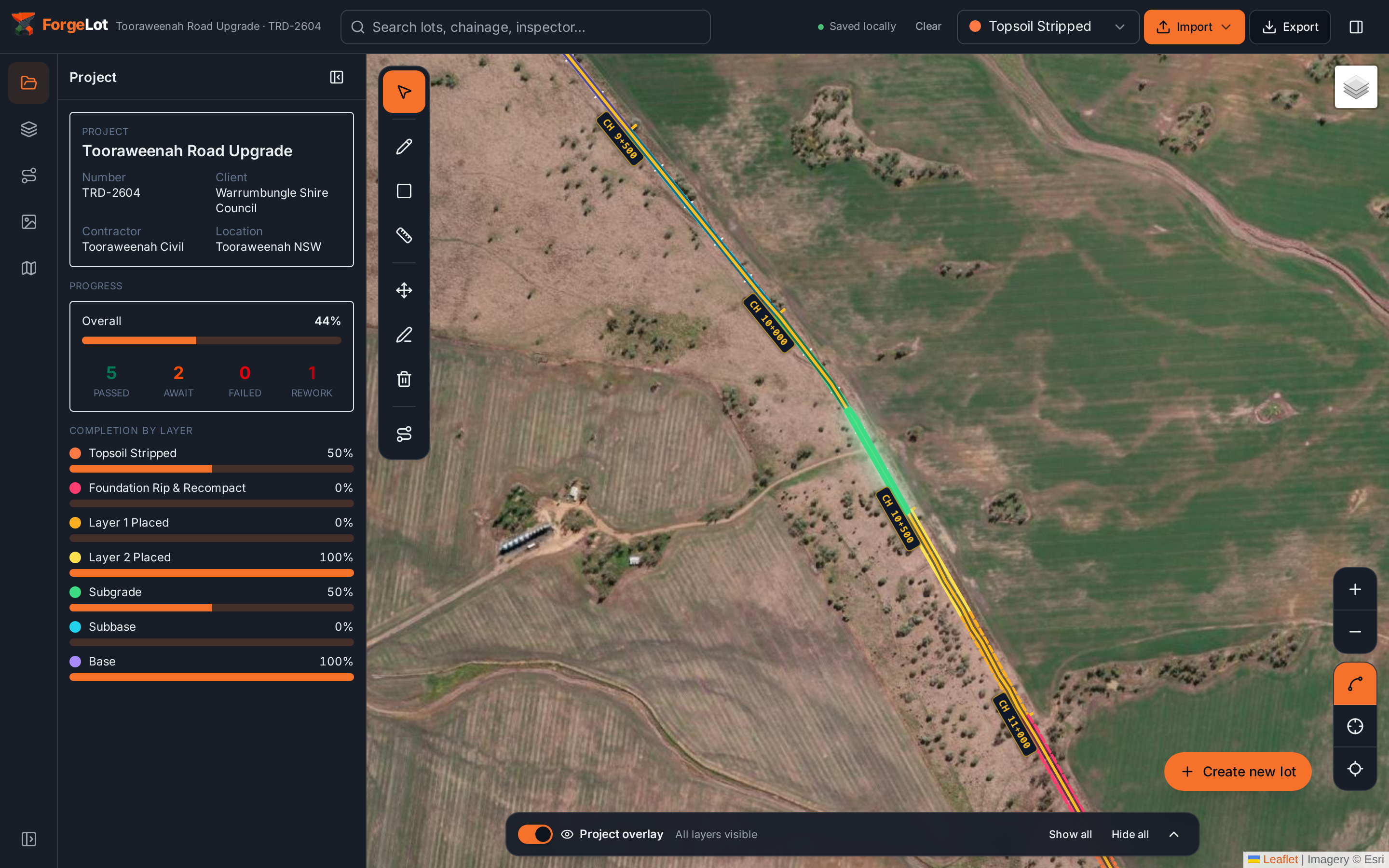
Bring one alignment and see how quickly ForgeLot turns it into a live lot register your team can use.
14-day free trial · Cancel anytime · Your data stays yours